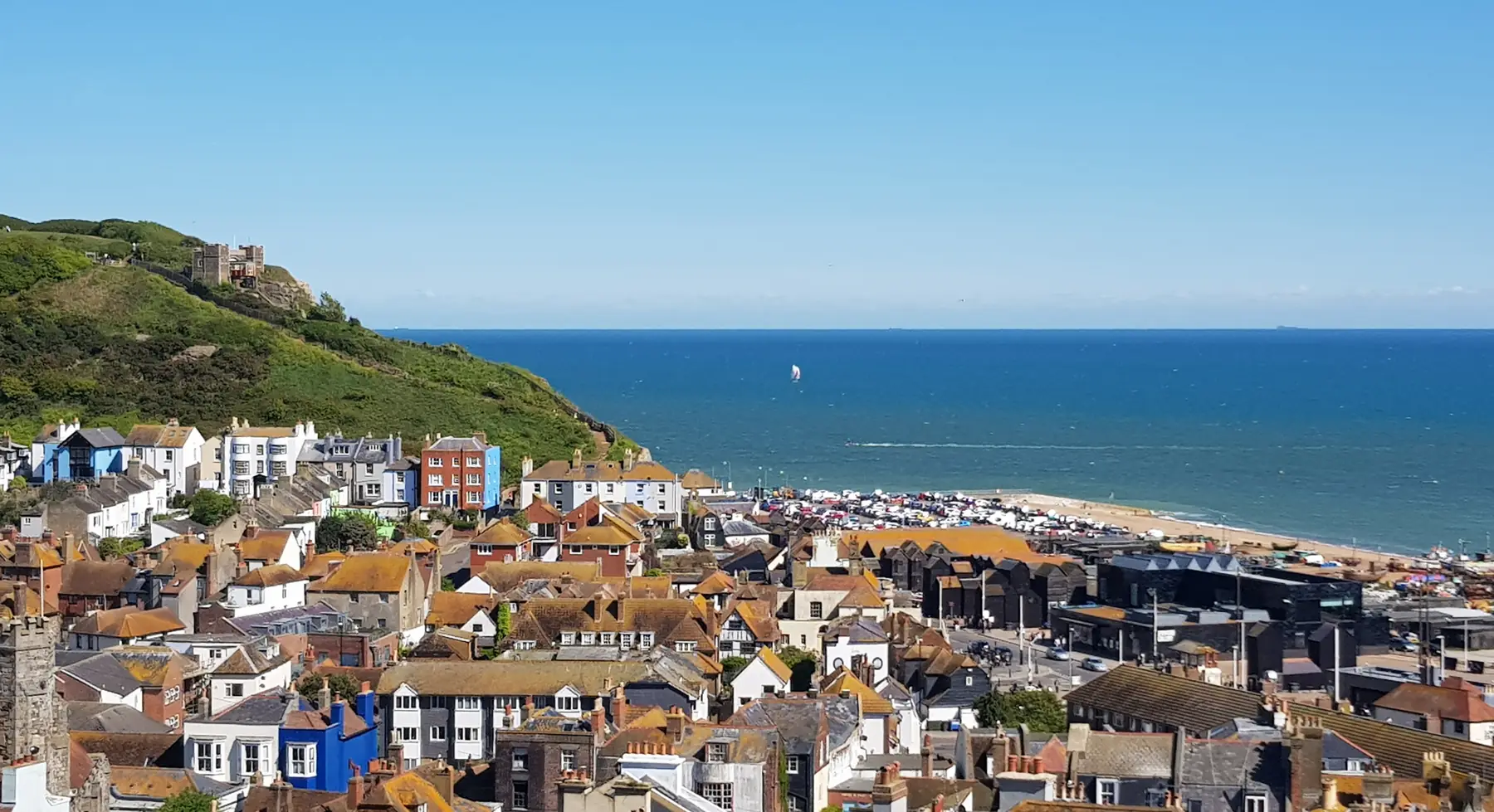
Hastings is built in a gap between two hills, which is the single fact that shapes walking here. The Old Town sits in the valley; the West Hill carries the castle and the caves; the East Hill rises straight out of the fishing beach and runs east into the finest stretch of undeveloped cliff between Brighton and Dover.
Because the town is at the bottom, every walk here starts with a climb — or, if you prefer, with a ride on one of the two Victorian funicular railways that exist precisely because Victorians did not want to climb either.
Distances are from the Old Town.
The East Hill Cliff Railway lifts you from Rock-a-Nore, at the eastern end of the fishing beach, to the top of the East Hill in a couple of minutes. It is one of the steepest funiculars in the country and it saves a genuinely stiff climb.
At the top you are on open grassland with the whole town, the fishing fleet and the Channel below you, and the path east into Hastings Country Park. Walking up and riding down, or the reverse, is the standard approach. See our East Hill Cliff Railway page.
The West Hill Lift runs from George Street in the Old Town up to the West Hill, where the ruins of Hastings Castle stand on the cliff edge — a Norman keep and bailey of which a large part has simply fallen into the sea over the centuries. The hilltop is open grass with views along the coast, and St Clement’s Caves and the Smugglers Adventure are underneath it.
The two hills, the Old Town between them and the seafront below make a circuit of about four kilometres with two climbs.
East of the town, the coast rises into a series of sandstone cliffs cut by deep wooded valleys — the glens — running down to the sea. It is a national nature reserve, it is free, and it is the best walking in this part of Sussex.
Ecclesbourne Glen is the first, reached along the clifftop from the East Hill, with a steep wooded valley and a beach at the bottom. Fairlight Glen is the next, deeper and wilder, with a waterfall on the beach. Warren Glen and Fairlight Cove continue east.
The full clifftop walk from the East Hill to Fairlight is about seven kilometres one way, with substantial climbing in and out of each glen — it is far harder work than the distance suggests. There is a car park and visitor centre at Fairlight, and a bus back.
A caution: the cliffs here are soft sandstone and they slip. Paths are diverted from time to time and some of the glen routes to the beaches have been closed at various points. Follow the signs rather than an old map, and stay away from the edge.
A kilometre inland, and one of the best Victorian parks on the south coast — sixty-odd acres of lakes, streams, specimen trees and formal planting, opened in 1864 and redesigned by Robert Marnock in 1877. A chain of ponds runs up the valley, and you can walk from the town centre right through the park and out into open country beyond. Flat, free and largely unknown to visitors. See our Alexandra Park page.
From the Stade at the eastern end, past the pier, and west into St Leonards — several kilometres of level promenade. The St Leonards section includes Bottle Alley, a covered lower promenade with walls decorated in broken glass, which is either grim or magnificent depending on the light and your mood.
Not a walk so much as a wander, but the network of narrow passages — twittens — between the High Street and All Saints Street is the best half hour in Hastings. Steep steps, hidden gardens, timber frames, and a townscape that survived because the Victorian resort was built to the west of it.
A waymarked long-distance path running from Pevensey through Battle to Rye, thirty-one miles in total, passing through the ground the Norman army covered in 1066. The Hastings to Battle section, about sixteen kilometres, is a fine day’s walk through the High Weald with the abbey at the end and a train back. Our 1066 guide covers the history.
The coast path continues east from Fairlight to Winchelsea and Rye, past Camber Castle and the vast shingle of Rye Harbour Nature Reserve, which is one of the best bird sites in the south-east. Rye is fifteen kilometres away and there is an hourly train back.
North of the town the High Weald National Landscape is a long-settled countryside of small fields, ancient woodland, sunken lanes and scattered farms. Battle Great Woods, Brede and the country around Robertsbridge are all within twenty kilometres and almost entirely free of visitors.
Trains make linear walks easy: Rye and Winchelsea are on the Ashford line, Battle and Robertsbridge on the Charing Cross line, and Bexhill and St Leonards are a few minutes west.
Parking. Rock-a-Nore is the car park for the Stade, the East Hill and the country park; Pelham Place is the central seafront one. Both are busy in summer.
Underfoot. The glens are steep, muddy and rooty. The clifftop is exposed. The Old Town is steps.
Tides matter if you plan to walk on the beach below the cliffs — several of the glen beaches are cut off at high water.
Spring is the best season for the glens: bluebells in the wooded valleys of Hastings Country Park, the cliffs green, and the paths dry enough to be pleasant. It is also when the Old Town is at its liveliest, with Jack in the Green over the May Day weekend.
Summer brings the crowds to the seafront and leaves the country park surprisingly quiet — most visitors go no further east than Rock-a-Nore. The glens are shaded and cool, which is a real advantage on a hot day.
Autumn is the best walking of the year here: the High Weald turns, the light comes in low off the sea, and the coast path east to Fairlight is at its clearest.
Winter is when the cliffs are at their most dramatic and their most treacherous. The sandstone holds water, the glen paths become slides, and landslip closures are commonest after prolonged rain. The seafront, Alexandra Park and Bottle Alley are the alternatives.
Hastings Country Park is one of the most actively eroding stretches of coast in the south-east. The cliffs are soft sandstone over clay, and sections slip regularly — sometimes taking a path with them. Access to the beaches at the foot of Ecclesbourne and Fairlight glens has been affected at various times, and routes are re-signed as the ground moves.
The practical advice is simple: take the current waymarking as authoritative rather than a map or a guidebook, do not go near the cliff edge or sit at the foot of the cliff, and check the tide before walking on any of the beaches below, several of which are cut off at high water.
The East Hill and Ecclesbourne Glen for the cliffs; Alexandra Park for a flat hour; the 1066 Country Walk to Battle for a full day.
It is one of the steepest funicular railways in the United Kingdom, which is why it exists.
Yes, along the coast via Fairlight and Winchelsea — around twenty-five kilometres, usually split over two days, with trains back.
Yes. Only the car park at Fairlight is charged.
The paths are, but the cliffs are soft sandstone and subject to landslip. Routes are diverted from time to time — follow the current signs and keep away from the edge.